
Where Is Dublin? Location, Geography & Orientation
Dublin sits on Ireland's east coast at the mouth of the Liffey. Location, terrain, north-south divide, postal districts and the airport transfer explained.
Contents
Location and terrain
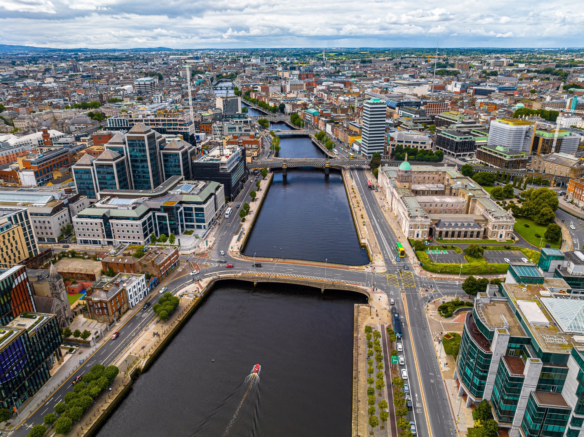
Dublin lies on Ireland's east coast, where the River Liffey flows into the wide Dublin Bay and, beyond it, the Irish Sea. Geographically the city sits at around 53°N and 6°W. The urban area itself is flat and only a few metres above sea level, a typically Irish mix of coastal plain and gentle hills on the horizon.
The sharpest contrast comes from the Wicklow Mountains to the south. On a clear day they define the city's skyline and give way, further south, to the national park of the same name. Two headlands frame the bay to the north and south - Howth Head in the north, and the hills around Dalkey and Killiney in the south, both popular viewpoints over the bay, city and mountains.
If you want to experience the terrain on foot, head out to the coast. The hills south of the city offer elevated views across the whole of Dublin Bay; on a very clear day the view stretches east across the Irish Sea. Exact elevation figures for individual hills vary by source, the appeal is the panorama itself, not the metres.
Climate at a glance
Dublin's climate is Atlantic and mild, without major extremes. Under the official 1991-2020 normal (Dublin Airport station, Met Éireann), the warmest month is July, with a mean temperature of 15.4°C and an average daily high of 19.5°C. January averages 5.2°C. Annual rainfall at the airport is around 772 mm, making Dublin notably drier than Ireland's west coast.
Rain falls year-round, with November the wettest month. The drier stretch tends to fall in late spring (February to May). For trip planning, there's no officially "ideal" month, but May/June and September are generally favourable thanks to long days, comparatively lower rainfall and smaller crowds. Pack a jacket even in high summer. For all figures, rain days and details, see the full guide to Dublin's weather.
City layout, north and south of the Liffey
The Liffey splits Dublin into a north side and a south side, and that divide still shapes how the city sees itself. Traditionally the north was seen as working-class and the south as more affluent. That cliché only holds up partially in 2026, northern neighbourhoods like Stoneybatter and Smithfield (Dublin 7) have been strongly gentrified, with fashionable cafés and rising rents. Local voices criticise the displacement of the old working-class culture. So the historic north-south divide is best treated as an outdated cliché, overtaken by ongoing gentrification in the north.
Right on the south bank is Temple Bar, the best-known nightlife district, with cobbled streets and pub-lined lanes. Honestly assessed, Temple Bar in 2025/26 is less an authentic cultural quarter than an overrun party and tourist district, it regularly turns up in lists of the "worst tourist traps" worldwide, criticised for inflated prices and stag parties. It's still worth a look, though, and does hold genuine culture, among them the Project Arts Centre, the Irish Film Institute with its arthouse cinema and film archive, the Gallery of Photography and Temple Bar Gallery + Studios. More in our guide to Temple Bar.
On the western end of the north bank is Phoenix Park, one of the largest walled city parks in Europe, open free of charge year-round, around the clock. It's home to the official residence of the Irish President, the residence of the US ambassador, and Dublin Zoo. We cover the park in detail in our guide to Phoenix Park.
Understanding the postal districts
Reading Dublin addresses, you'll quickly run into designations like "Dublin 2" or "Dublin 7". This system was introduced in 1917 by the British administration, modelled on London and Liverpool, to let post be sorted efficiently by hand. The districts radiate out from the General Post Office on O'Connell Street.
- Rule of thumb: odd numbers (Dublin 1, 3, 5 …) lie north of the Liffey, even numbers (Dublin 2, 4, 6 …) south. That's a big help for first-time orientation.
- Well-known exception: Phoenix Park belongs to Dublin 8 (even), despite lying north of the river.
- Sought-after addresses: Dublin 2 (the southern city centre with Trinity College and Grafton Street) and Dublin 4 (southeast, upmarket) are considered the central or pricier addresses.
The numbers remain a fixed part of everyday addresses today, even though they only really came into public use from 1961.
Getting to Dublin
By air: Dublin Airport (DUB) is about 10 to 12 km north of the city centre; the road distance is roughly 17.5 km. As of 2026 there is no rail, tram or metro link, the MetroLink is only planned. From the airport you can reach the city like this:
- Airport coaches: Aircoach (route 700) and Dublin Express each cost around €10 per one-way trip; Aircoach runs around the clock every 15 to 30 minutes, and advance booking online is possible.
- Public buses: Dublin Bus routes 16 and 41 cost only around €2 with a Leap Card (about €2.60 in cash), but take longer and stop more often.
- Taxi, Uber, Free Now or Bolt: from the taxi ranks right outside both terminals, roughly €25 to €35 depending on traffic.
- Journey time: usually 25 to 40 minutes into the centre, up to an hour at peak times.
Full details on all these options are in our guide to Dublin Airport.
By ferry: Dublin is well connected across the Irish Sea. Stena Line and Irish Ferries link Dublin Port with Holyhead in Wales, a crossing of around 3 hours 15 minutes, with roughly four sailings a day each. Note, the main ferry port is Dublin Port, not Dún Laoghaire, whose ferry service has been discontinued for years. Prices vary widely, foot passengers pay from around €40, with a car considerably more. Because of construction work, Alexandra Road within the port is expected to be closed to port traffic until autumn 2026 (access via Promenade Road instead). More in our guide to ferries to Dublin.
Getting around - DART, Luas, bus
Within Dublin the easiest way to get around is by rail, tram and bus, most cheaply with a Leap Card.
- DART: the coastal commuter rail line runs in 2026 from Howth and Malahide in the north down to Greystones in County Wicklow in the south. Woodbrook became the 32nd station in August 2025; the DART+ expansion is under way.
- Luas: the tram network still has two lines, the Green Line (Broombridge-Bride's Glen) and the Red Line (The Point/Connolly-Tallaght/Saggart). No new line has opened as of 2026; the "Luas Finglas" extension was approved in April 2026 but has not yet been built.
- Bus: the bus network covers areas that rail and tram don't reach.
The main railway stations are Connolly Station on the north side and Heuston Station in the west. All tickets, frequencies and tips are in our guide to public transport in Dublin.
Day trips from Dublin
Dublin's location makes day trips into nature and to Irish World Heritage sites easy. Rather than London or Paris, which are really only relevant as flight destinations, it's the Irish countryside around Dublin that pays off most:
- Wicklow Mountains National Park & Glendalough: about 50 km south, roughly 45 to 50 minutes by car. Glendalough, the "valley of the two lakes", is an early medieval monastic site founded by St Kevin in the 6th century, with waymarked trails ranging from an easy lake loop past the Poulanass waterfall to the more demanding Spinc walk. There's no direct DART or rail link; you go by car or with St. Kevin's Bus (twice daily from St. Stephen's Green/Leeson Street, around 1 hour 15 minutes, roughly €23 per person, Leap Card accepted).
- Boyne Valley & Newgrange: about 50 km north, a UNESCO World Heritage site with prehistoric passage tombs.
- Cliffs of Moher and the Ring of Kerry: classic Ireland destinations in the west and southwest respectively, but several hundred kilometres away, better suited to a guided full-day tour than a relaxed day trip.
Guided tours to these destinations are listed under Tours & day trips.